New York City Faces Extreme Flood Risk Threatening Millions, Study Reveals
A groundbreaking assessment highlights eight U.S. East Coast cities at high risk of catastrophic flood damage.
LAT Editorial Team

Anuncio
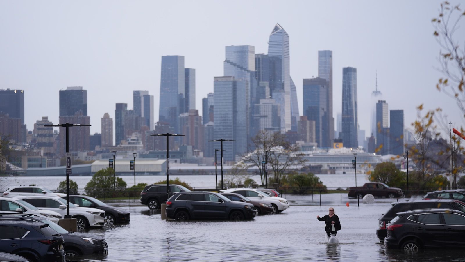
A recent study has identified New York City as the U.S. East Coast city with the highest number of people and buildings at risk of extreme flood damage, putting approximately 4.4 million residents in jeopardy. Alongside New Orleans and six other cities, the findings reveal a looming threat from flooding exacerbated by climate change and rising sea levels.
This research underscores the urgent need for policymakers to implement comprehensive flood mitigation strategies, combining nature-based solutions with infrastructure improvements to protect vulnerable urban populations and critical infrastructure from devastating flood events.
Anuncio
Cities on the Frontline: Who’s Most at Risk?
The study highlights eight East Coast cities facing high or very high flood risk: New York City, New Orleans, Houston, Miami, Norfolk (Virginia), Charleston (South Carolina), Jacksonville (Florida), and Mobile (Alabama). New York tops the list with nearly half its population and buildings exposed to extreme flood damage, while New Orleans faces the highest relative risk, with almost the entire city vulnerable.
- New York City: 50% population (~4.4 million) and 47% buildings at high risk
- New Orleans: 98% population (~375,000) and 99% infrastructure at risk
- Houston, Miami, Norfolk, Charleston, Jacksonville, Mobile also at significant risk
Anuncio
How the Risk Was Assessed: A Data-Driven Approach
Researchers employed machine learning techniques analyzing historical flood damage data from FEMA, including major hurricanes like Isaac (2012) and Irma (2017). They developed a flood risk index based on 16 factors such as elevation, proximity to water, population density, and socioeconomic vulnerability, enabling precise predictions of extreme flood damage exposure.
Anuncio
Why These Cities Are Vulnerable
The combination of low elevation, dense populations, inadequate drainage, and proximity to water bodies makes these cities particularly susceptible. Climate change-driven sea level rise—projected to increase by up to one foot by 2050—and intensifying hurricanes further amplify flood risks along the Gulf and Atlantic coasts.
"Such policies should restrict further urban development in high-risk zones while promoting the systematic incorporation of nature-based solutions,"—Study authors
Anuncio
Mitigation Strategies: What Can Be Done?
The study urges policymakers to prioritize flood risk reduction by integrating natural solutions like restoring wetlands and floodplains with engineered defenses such as levees and floodgates. Simple measures, like replacing impermeable parking lots with permeable grass tiles, can also help absorb excess water and reduce damage.
With nearly 30% of counties along the U.S. coasts at high flood risk, coordinated efforts involving local stakeholders are essential to safeguard communities and infrastructure from increasingly frequent and severe flooding events.
Anuncio
Looking Ahead: Preparing for a Flood-Prone Future
As climate change accelerates, the threat of extreme flooding will only grow. This study provides a crucial roadmap for identifying vulnerable urban areas and highlights the pressing need for adaptive policies and investments to protect millions of residents and billions in infrastructure from catastrophic flood damage.